Flow Type
SECTION E: PHYSICAL ATTRIBUTES – FLOW TYPE
Recognising flow-types in the field
The nine flow-types used for RHS are largely based on patterns of the surface, velocity, flow direction and the influence of river bed substrate. Flow-type at a particular location will vary with different volumetric discharges and river levels, but the definitions used correspond to those occurring during dry-weather conditions.
Relying on photographs for recognition of flow-types is inadequate. Many of the diagnostic elements for flow-types come from other clues such as movement, sound and position in relation to channel features. An RHS geomorphology training video has been produced which describes characteristics of all the flow-types. All RHS surveyors should study the video as part of their overall training.
In all instances, the predominant flow-type (i.e. that normally occupying at least 50% of the wetted channel) must be recorded and only one entry per spot-check is allowed. Where there are two flow-types both occupying about 50% of the wetted channel, the faster flow-type should be recorded.
Beware: strong or gusty winds give a false impression of flow (e.g. wind-dragged ripples may suggest ‘rippled’ flow when flow-type is actually either ‘smooth’ or ‘no perceptible’). Windy conditions should be recorded in Section A as a factor affecting survey conditions.
Boxes are emboldened, so only a single entry per box (the predominant flow-type) is permissible.
Not visible (NV)
This should only be used when the watercourse is in a long culvert and the flow-type cannot be seen.
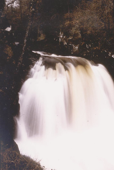
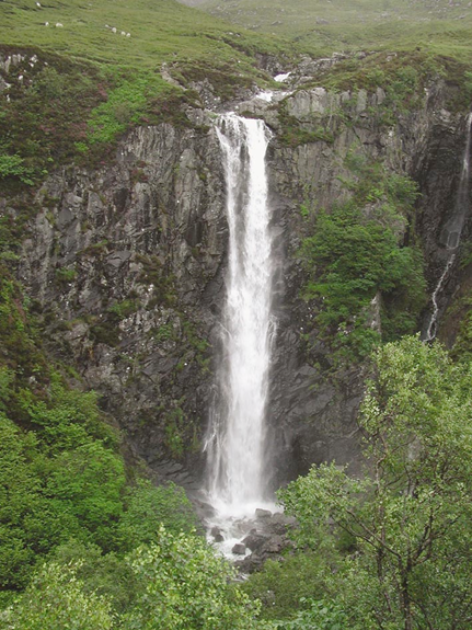
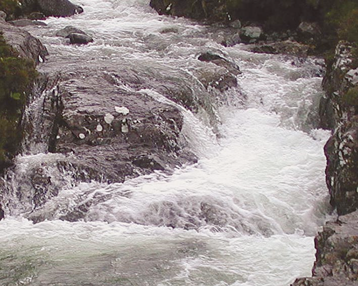
Free fall (FF)
Where vertically-falling water clearly separates from the ‘back-wall’ of a distinct vertical rock face. Generally associated with waterfalls.
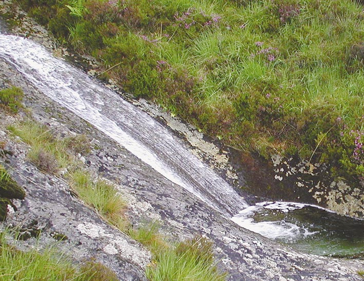
Chute (CH)
Low, curving flow with substantial water contact ‘hugging’ the substrate. Where multiple chutes occur over individual boulders or bedrock outcrops, a ‘stepped’ profile is created. Mostly associated with cascades.
Broken standing waves (BW)
These are the ‘stoppers’ favoured by canoeists and rafters but they may occur on a more localised scale where water appears to be trying to flow upstream. A white water tumbling wave must be present for the wave to be described as broken. Mostly associated with rapids, but may occasionally occur within riffles.
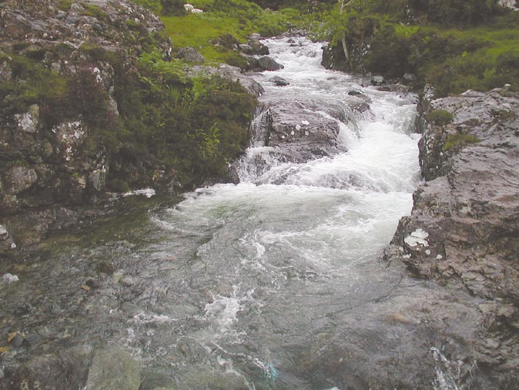
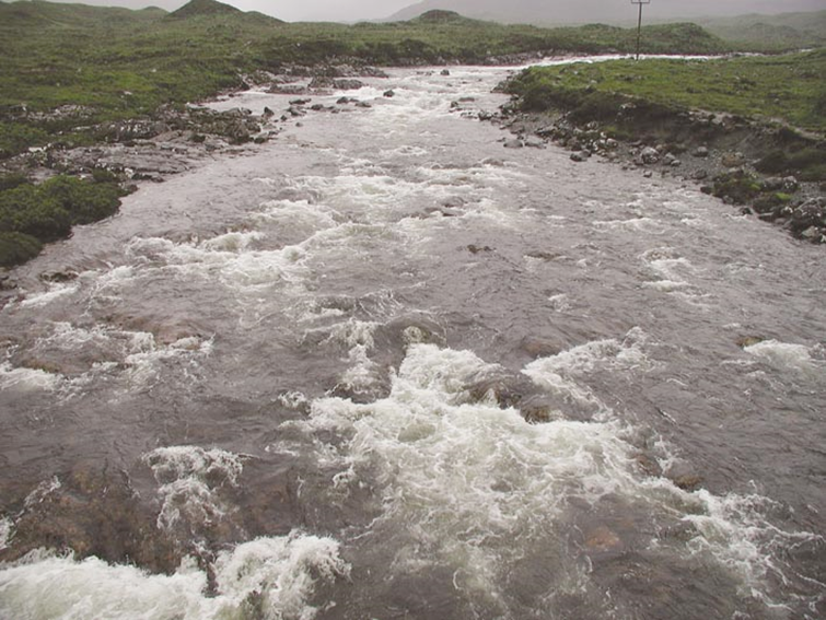
Unbroken standing waves (UW)
‘Babbling’ water with a disturbed ‘dragon-back’ surface, which has upstream facing wavelets that have not broken. White water may occur as crest waves, not as breaking waves. Mostly associated with riffles, but may also occur within a rapid.
Chaotic flow (CF)
A chaotic mixture of several faster flow-types (e.g. FF, CH, BW and UW) in no organised pattern. This category should be used only where there are three of these fast flow-types at a spot-check, and where no one of them is clearly predominant. Not to be used as a ‘catch-all category’.
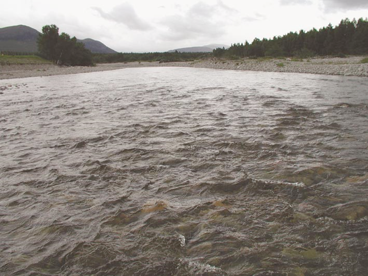
Rippled (RP)
Water surface with distinct, symmetrical, small ripples that are generally only a centimetre or so high and moving downstream. Beware: in windy conditions smooth flow can have wind-induced ripples on the surface.
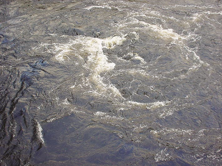
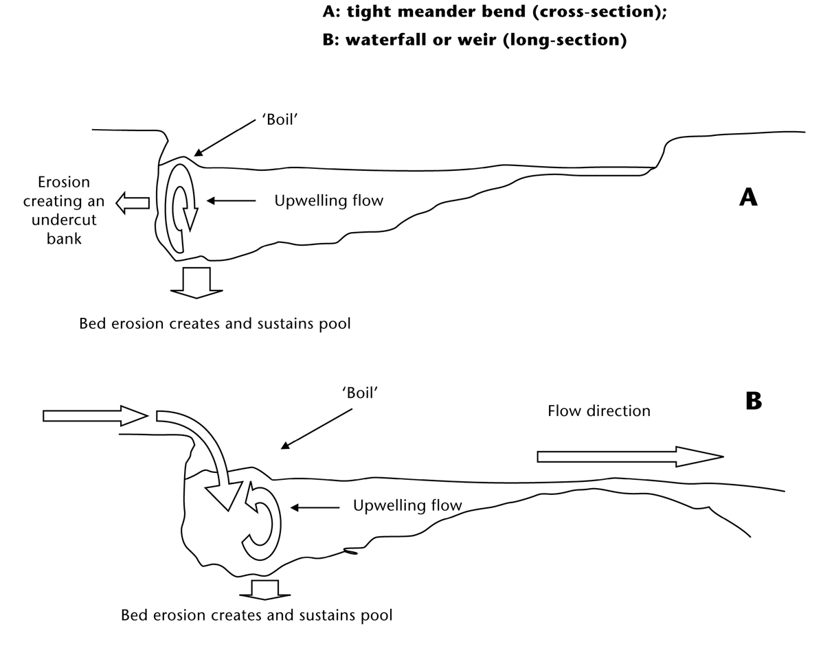
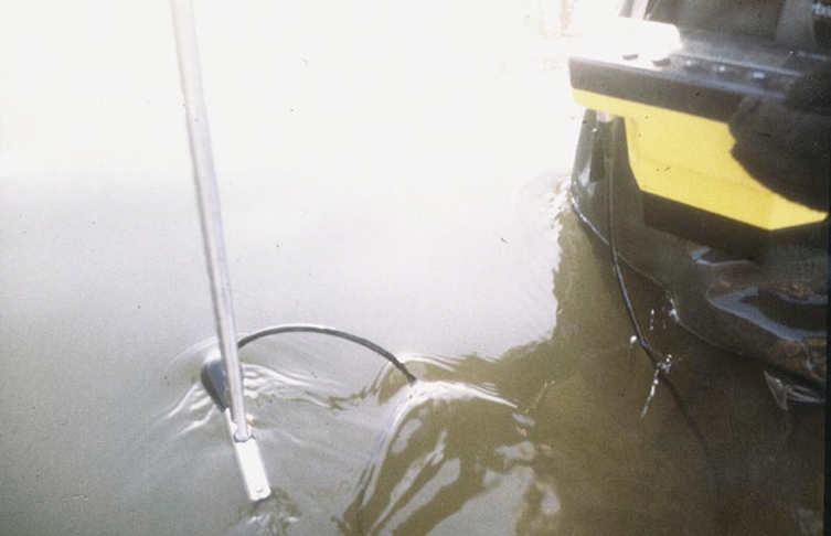
Upwelling (UP)
Upwellings are found where strong upward flow movements disturb the surface, creating an appearance of bubbling or boiling water (see figure below). Upwellings are sometimes also called ‘boils’. They are typically found on the outside of tight meander bends, behind in-channel structures (e.g. bridge abutments) or below waterfalls, cascade weirs and sluices. Upwellings also help maintain the depth of pools by their scouring action, but also produce lateral bank erosion on meander bends.
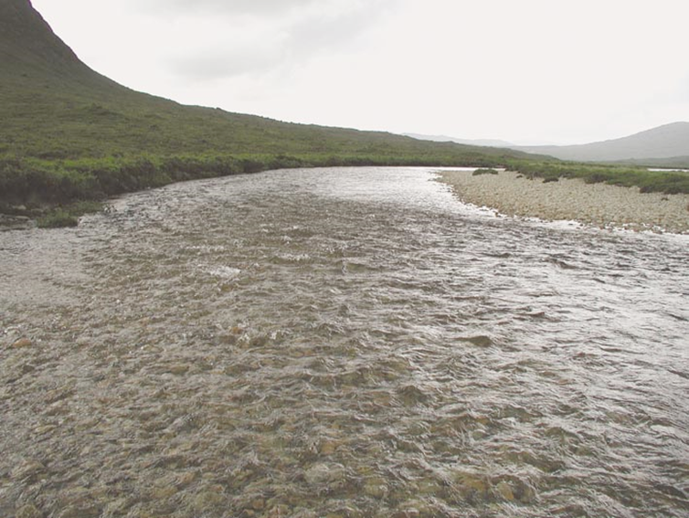
Smooth (SM)
Laminar flow where water movement does not produce a disturbed surface. If in doubt, put a ranging rod into the water (or observe shadows on the bed in clear water) and you will artificially produce disturbed surface movement either side of the rod or shadow. Mostly associated with glides.
No perceptible flow (NP)
In ponded reaches (such as upstream from natural bedrock controls and weirs), it may be difficult to perceive any surface water movement. When using the ranging rod test (as in ‘SM’), no surface movement of water will be seen. If associated with impounded reaches above dams, note in Section D. Marginal deadwater (Section K) has no perceptible flow, as will stagnant pools in prolonged dry conditions. Also used to record flow in pools where there is obvious rotational surface flow, but no obvious net downstream movement of water at the surface.
No flow (DR)
When a channel is dry, either naturally or due to excessive water abstraction in a dry year, record flow as ‘DR’. In limestone or chalk areas, dry reaches will occur downstream from sinkholes or in headwater winterbournes that naturally dry annually. Record channel, bank and bed materials as if flow was present, EXCEPT for dry channels with soil/earth beds – record as ‘EA’. Record channel vegetation according to ‘type’, and provide notes in Section P. Do not include terrestrial vegetation.
In rivers with pools present between long stretches of dry channel, record ‘DR’ in spot-checks where the channel is dry, and ‘NP’ if spot-checks are located at pools.