Citizen River Habitat Survey
The Citizen River Habitat Survey or cRHS, was designed for members of the public and non-specialists to collect core RHS data and gather additional evidence using photos, videos and 360 photos to enable expert RHS surveyors to collect additional information form more information, go to the official cRHS site). A cRHS will collect 75% of a standard RHS form. With the use of videos, photos and 360 virtual walks, as well as interacting with the cRHS surveyor, an expert RHS surveyor should be able to collect up to 15% additional information, thus enabling the computation of all RHS quality indices and their comparison to sites of similar types.
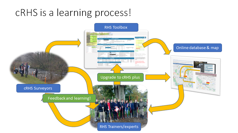
The cRHS was designed as a learning process (see figure below). Surveyors collect data that are shared online, reviewed by a specialist, thus creating an opportunity for knowledge exchange between citizen scientists and more expert surveyors. The outcome will be an upgraded cRHS form we call 'cRHS plus' and a deeper understanding of site quality, river processes and local site characteristics for both non-expert and expert surveyors.
The RHS Toolbox plays an essential role for the upgrade of citizen River Habitat Surveys. With the RHS Toolbox, users can upload their data, photos and videos, create virtual surveys with 360 photos and share them online on the cRHS platform.
The process for upgrading a cRHS is simple. A surveyor uploads their data on the cRHS platform as open or restricted access, and a surveyor with the right level of credentials can download them and complete the survey using the video and photo material. Once the upgrade is complete, the reviewer can upload the 'Citizen RHS plus' site online. The Citizen RHS surveyor will then be able to download the upgraded version on the PC.
Citizen RHSupgrade process
The process for upgrading a cRHS is simple. A surveyor uploads their data on the cRHS platform as open or restricted access, and a surveyor with the right level of credentials can download them and complete the survey using the video and photo material. Once the upgrade is complete, the reviewer can upload the 'Citizen RHS plus' site online. The Citizen RHS surveyor will then be able to download the upgraded version on the PC.
Importing cRHS data
With the RHS Toolbox, you can import cRHS data from the online database provided that you have a 'Reviewer' or higher credentials. The standard credentials for the Toolbox users is 'Surveyor'. With such status, all you can do is export cRHS data online but not import them. You can get an upgrade by contacting the RRC team and requesting an upgrade based on your qualifications. You need to be an experienced and certified RHS surveyors to be able to download and upgrade cRHS surveys. Once you are upgraded, you will be notified the next time you open the RHS Toolbox and you will have access to import and upgrade tools. To import cRHS data, go to the following help section: Importing cRHS from online database
Viewing and upgrading to cRHS plus
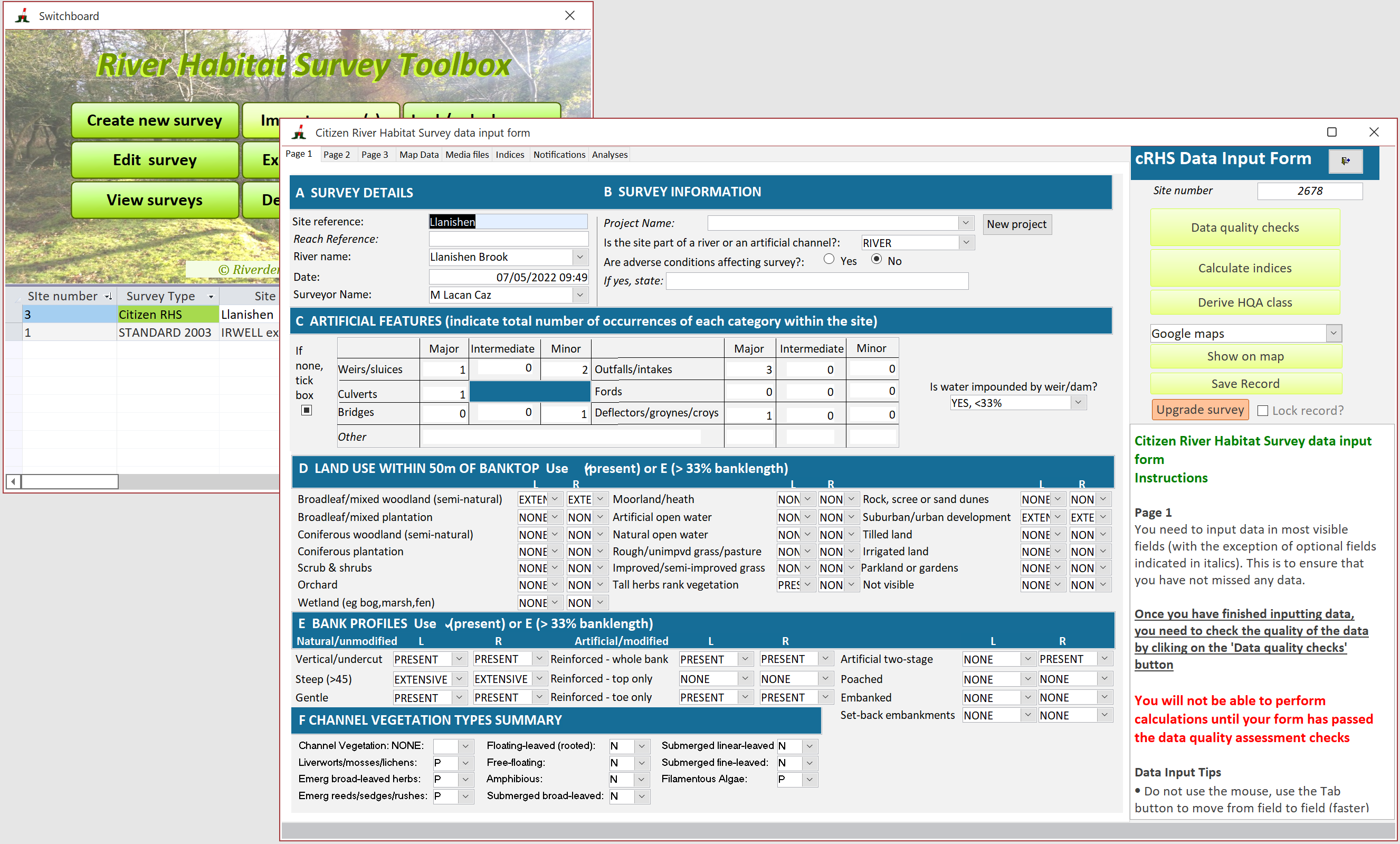
Once imported, you can view the survey data using the switchboard. Please notice the ![]() button on the cRHS form.
button on the cRHS form.
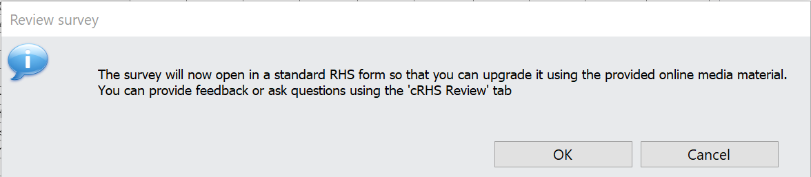
By pressing this button, you will start the upgrade process and it will re-open the survey in a full RHS form.
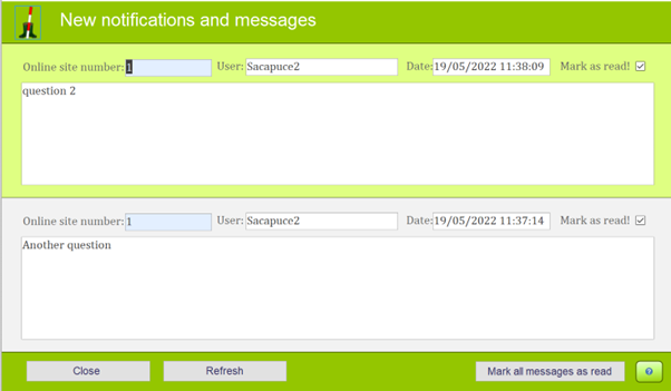
The RHS form will contain the data from the cRHS and will display blank fields that the reviewer will attempt to fill in using the map, photo and video evidence, as well as discussions with the surveyor. A new 'cRHS Review' tab will appear the next time the RHS Toolbox is opened and the survey is edited, that will enable the reviewer to communicate with the surveyor and exchange information. The cRHS surveyor will be notified by email that someone (your name will not be given, just an ID number) has downloaded and is upgrading their survey.
Please note that the photos and video files are not imported during that process and that they need to be viewed using the online cRHS map
Using the photos and videos, online resources such as topographic and historical maps, and with the help of the surveyors, the reviewer will fill in as much information as possible in the form. Below is a list of the fields that can be completed by the reviewer:
Page1
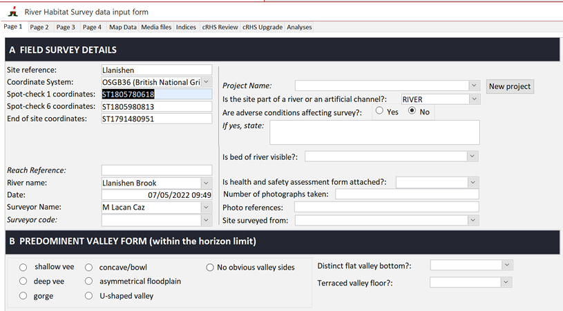
Section A: Generic information to be discussed with the surveyor
Section B: Valley form to be derived from videos and topographic maps using the contour lines. The presence of a distinct flat valley bottom (ie a floodplain) can be inferred from the videos. Terraces may also be observable from photos and videos as well as contour maos.
Section C: If 360 photos are available for the whole site at 5-10m interval, it may be possible to count riffles, pools and point bars.
Section D: The reviewer should quality check the recorded artificial features and identify from maps and photos and videos whether the channel has been realigned and/or over-deepened.
Page 2
Section G: Reviewers should use the online videos to quality check and complete each spot-check data. The following data should be added, if observable:
Bank modifications: reviewers should look for the presence of resectioning
Bank features: when a cRHS 'side bar' was recorded, please check whether it is a side or point bar and modify accordingly. If a Natural berm is observable, please record it too.
Flow-types: using the still shot at the beginning of every video, identify and record the dominant flow-type across the spot-checks.
Channel modification: look for and record the presence of channel resectioning (ie over-deepening or over-widening).
Page 3
Section I: Using photos, videos and 360 photos, if available, try to differentiate between vertical bank profiles (vertical undercut and vertical + toe) and add information about the presence of observable composite and resectioned banks as well as natural berms.
Section K: Complete the information on the distribution of flow features. if possible, and complete/amend data on the extent of side and point bars.
Page 4
Section L: Assess whether the banktop is generally equal to the bankful based on photos, videos and discussion with the surveyor. Discuss other aspects such as substrate consolidation with surveyor or add missing values.
Section N: Evidence of choked vegetation from the photos and videos (channel; vegetation occurring over more than 33% of the channel bed)
Section P: Any major impacts, evidence of recent management, animals based on photos and videos and discussion with the surveyor?
Section Q: Presence and extent of alders
Once you have filled in all possible empty fields, run the Quality Control procedures and calculate all Indices, Extracting map data from nearby assessment points and run the Context analysis.
You are then ready to upload the upgraded survey online by using the cRHS Upgrade tab.
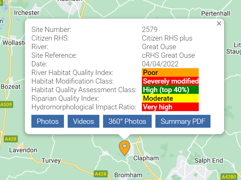
Once a site has been upgraded by a reviewer, it will be highlighted as a ‘cRHS plus’ on the online map. Beware, this process cannot be reversed so you should first check your survey data carefully before uploading it. If the Citizen surveyor is not happy with the upgrade, they can still delete the online site and upload the cRHS site again.