Section B: Valley Form
SECTION B: PREDOMINANT VALLEY FORM
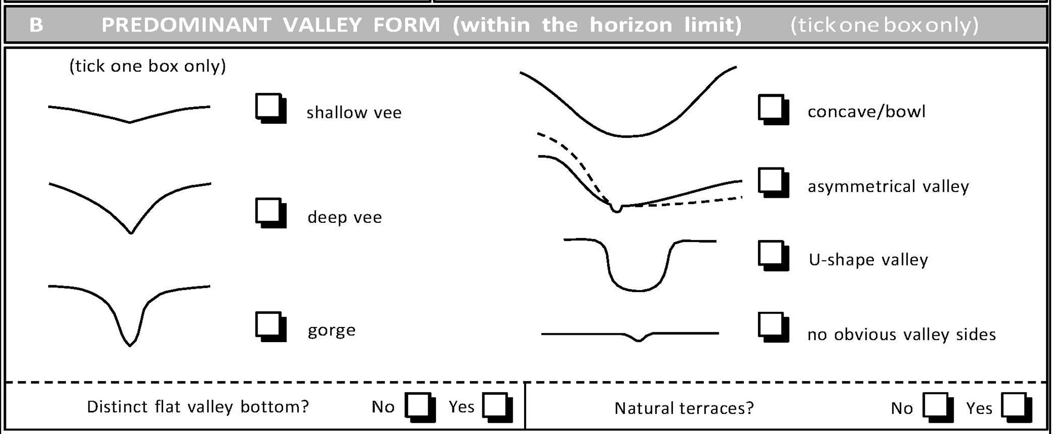
Profile diagrams are drawn on the form for guidance. Valley form refers to the shape of whole valley landform within which the RHS site is situated, assessed in the context of the horizon. It is the predominant valley form viewed by the surveyor when looking from the river to the mid-distant horizon. If you are unsure about a particular valley form, photograph and make a note or a sketch with an evaluation of distances. Tick one box only. The photos below show examples of different valley forms. Cross-sections are provided in Section L (channel dimensions) which also illustrate different valley forms.
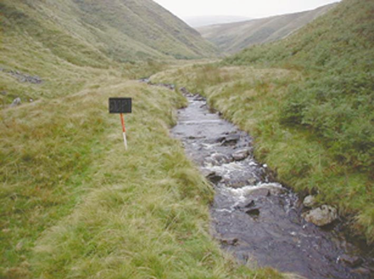
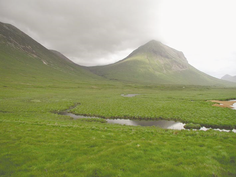
Shallow vee
Overall valley side slopes <30° from floor to top (horizon).
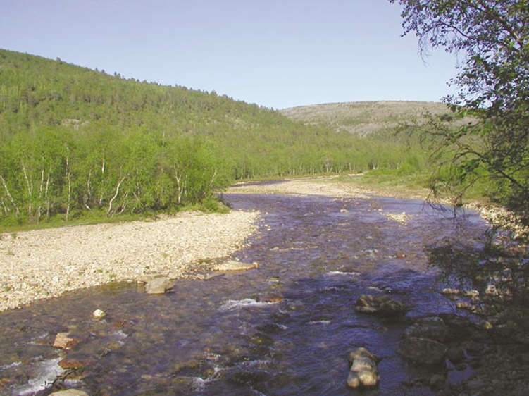
Examples of the Shallow Vee Valley Form
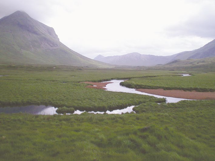
Deep vee
Overall valley side slopes 30° - 80° from floor to top (horizon).
Examples of Deep Vee Valley Form
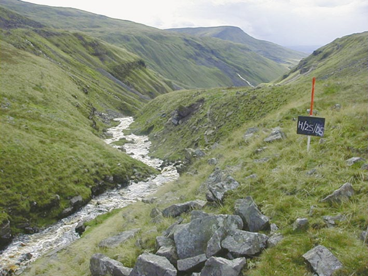
Gorge
Steep (80° - vertical), rocky, valley sides with narrow valley bottom.
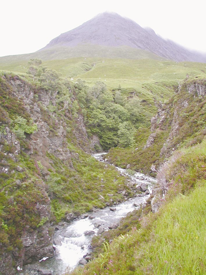
Example of the Gorge Valley Form
Concave/bowl
Gently curving slopes that do not have a distinct glaciated U-shape.
Example of the Concave/Bowl Valley Form
Asymmetrical valley
Valley sides are different, shallow on one side and steep on the other.
Example of the Asymmetrical Valley Form
U-shape valley
Steep valley sides rising from a flat valley floor that characterises a glacial valley.
Example of a U-shaped Valley Form
No valley-sides obvious
No obvious valley sides in near- to mid-horizon.
Example of the 'No Obvious Sides' Valley Form
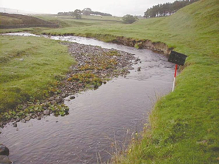
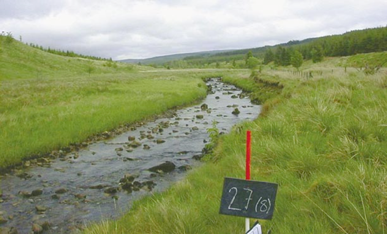
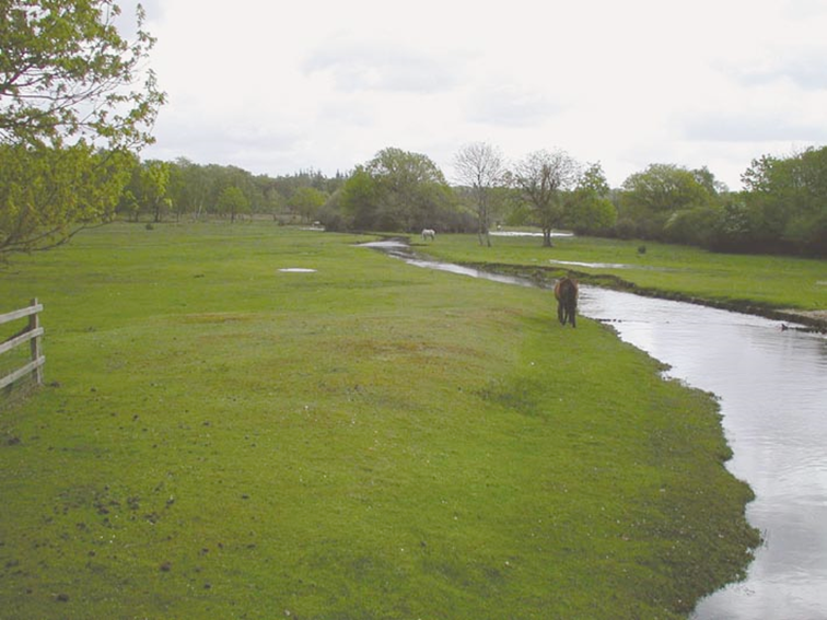
Distinct flat valley bottom?
Flat area of valley into which water would spill during floods. If not obvious, record ‘No’. Always tick ‘No’ box if no valley sides obvious.
Example of the Distinct Flay Valley Bottom Valley Form
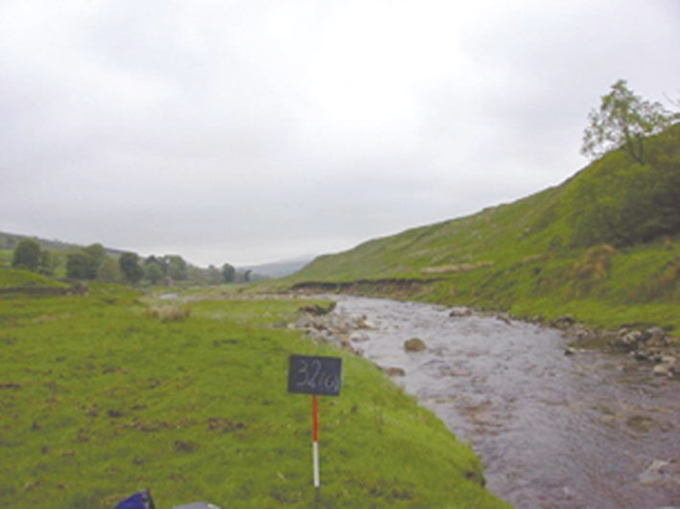
Natural terraces?
Distinct geomorphological features on a river valley floor forming steps or breaks in slope produced as the river erodes downwards. Characteristic of moraine-filled glaciated valleys.
Example of a Valley with Natural Terraces