Channel Features
SECTION E: PHYSICAL ATTRIBUTES - CHANNEL FEATURE(S)
Most channel features recorded by cRHS will not be obvious unless the river is flowing at dry-weather level, or below.
Boxes are NOT emboldened, so more than one entry is permissible (e.g. if unvegetated mid-channel bar and exposed bedrock present, record ‘MB’/‘EB’).
Not visible (NV)
Self-explanatory. Record ‘NV’ if flows are too high for accurate recording, or if mid-channel obstructions, including vegetation, obscure parts of the channel from view. Also use for culverts.
None (NO)
No channel features present. ‘NO’ must be entered if no other categories are recorded.
Exposed bedrock (EB)
Bedrock exposure protruding above the water at low flow.
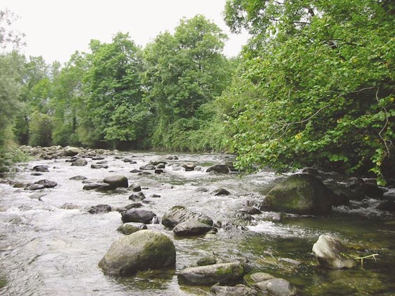
Exposed boulders (RO)
Naturally occurring large, (at least ‘head size’) boulders protruding above the water may be covered with mosses/liverworts in upland streams. Exposed boulders should only be recorded in spot-checks and in Section K if they are prominently protruding from the water, and where the predominant channel substrate is cobble, boulder or bedrock. In cases where boulder-sized material has been placed in the river for fishery enhancements, or has collapsed into the channel from boundary walls or rip-rap, this should be recorded as artificial (‘AR’) when predominant in the spot-check (i.e. material is out of context with the overall river bed character). Note the presence of failed reinforcement, or imported boulders for other purposes, in Section P
Vegetated rock (VR)
Bedrock or groups of boulders protruding from the water that have accumulated fine sediments in crevices which has allowed higher plant vegetation to become established (e.g. tall herbs, reeds, grasses, shrubs). Does not include rocks with only mosses or liverworts.
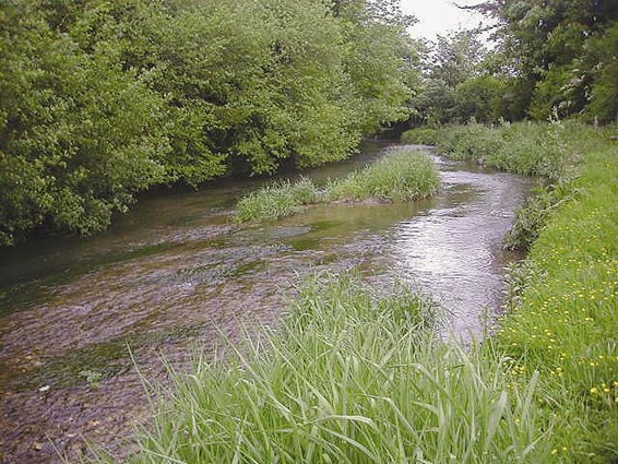
Bars and islands
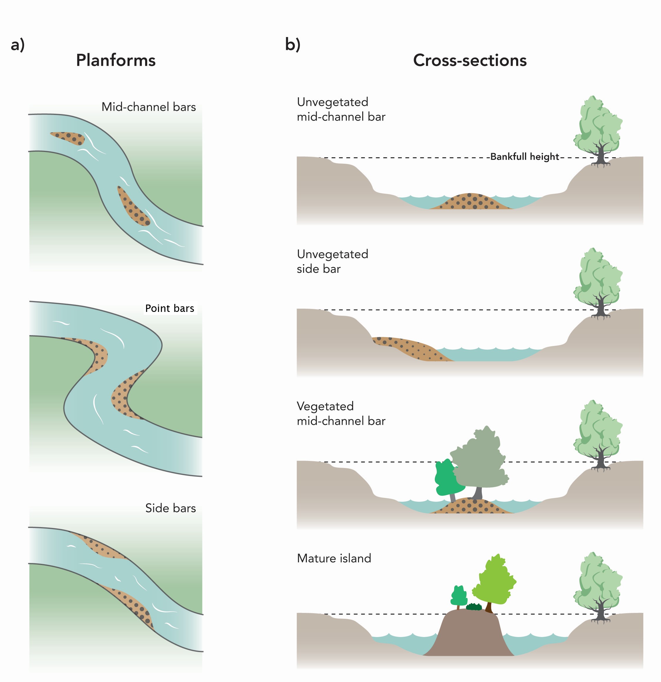
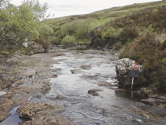
Unvegetated mid-channel bar(s) (MB)
A distinctive, in-channel, depositional feature composed of unconsolidated river bed material. Exposed at low flow, usually with shallow sloping sides into the water. Classified as ‘unvegetated’ if <50% of the total surface area has plant cover.
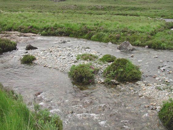
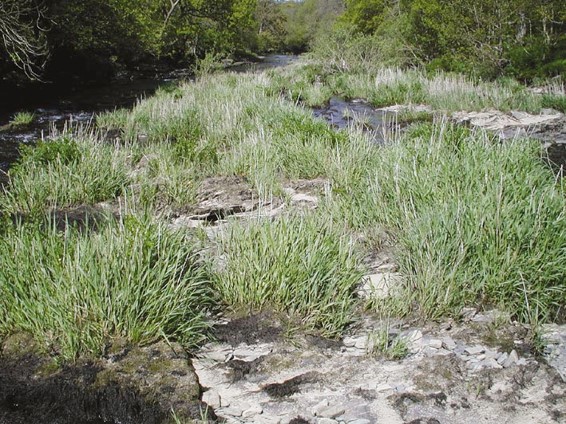
Vegetated mid-channel bar(s) (VB)
A distinctive in-channel depositional feature composed of consolidating river bed material. Exposed at low flow, usually with shallow sloping sides into the water. Classified as ‘vegetated’ if >=50% of the total surface area has plant cover. Vegetation may include perennials such as reed canary-grass, shrubs and trees.
Moss-covered substrates are also included as these indicate stability. Surface of bar is lower than the bank height, so the whole feature is submerged during large floods.
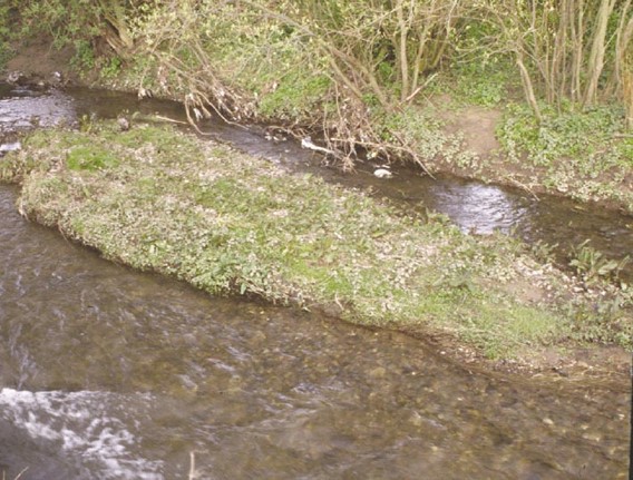
Mature island(s) (MI)
Permanent in-channel feature with the surface at the same height, or above, the bankfull height. Usually well vegetated, often with mature scrub and trees.
If significant deposits of fresh material surround a mature island, then both mature island (MI) and unvegetated mid-channel bar (MB) can be present – if so, record both at the spot-check because this indicates both the presence of a mature feature and active deposition.
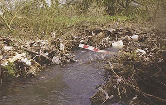
Trash [urban debris] (TR)
Rubbish such as bricks, shopping trolleys, piles of flotsam and jetsam etc.
Braided channels
Braided rivers are dynamic and mobile, where the channel is divided into several sub-channels separated by active mid-channel bars along most (>50%) of the 500m site. In braided rivers, most bars are unvegetated and the wetted area, at low flows, represents substantially less than 50% of the river bed. Bar surfaces are typically at lower elevations than the vegetated floodplain margins. Braided rivers must feature at least two sub-channels and two mid-channel bars along most of the site. Some of the sub-channels may be dry at the time of the survey. Recording features of braided channels is very difficult to do accurately, and surveys will take much longer to complete than on a more typical RHS site.
When recording spot-checks on braided channels, record the number of sub-channels (wet and dry) at each spot-check in the grey row dedicated for such records, and then record all channel features of a spot-check on the channel carrying the major flow at the time of survey.
Marginal and bank features, bank modifications and bankface vegetation structure records are all made from the outer edges of the two channels abutting the floodplain.