Section H: Land-Use within 50m of Banktop
SECTION H: LAND-USE WITHIN 50m OF BANKTOP
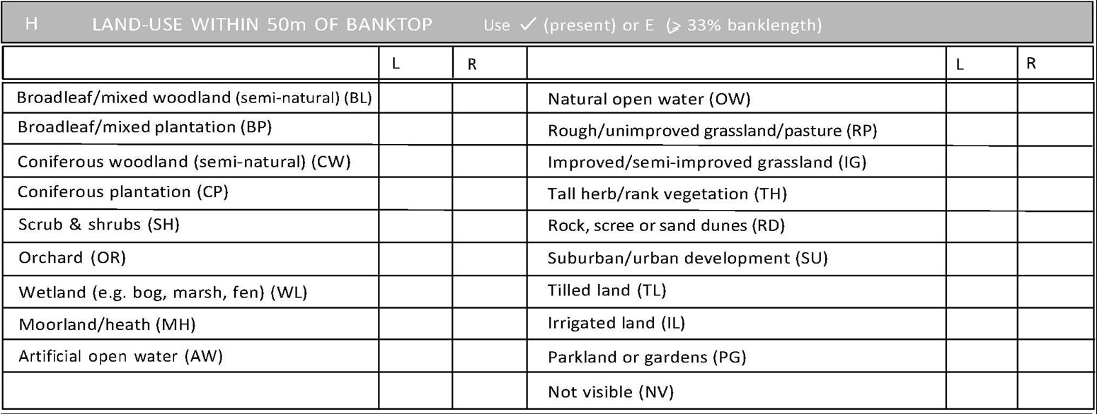
Record ‘E’ if a land-use type occurs along > 33% of bank-length, or 3 when it extends for 1-33% of the bank-length. Only record land-use occurring within 50m of the banktop. Record left and right sides of the watercourse separately. Where two parallel land-uses border the river (e.g. along 50% of one bank there is a 20m grassland strip giving way to arable) - both are recorded as ‘E’. Moreover, if the other 50% is a parallel pattern of urban and artificial open water, these too are both recorded as ‘E’. Therefore, in exceptional circumstances, more than three ‘E’ categories can be recorded for one bank.
Use the prompts on the form. For descriptions of land-use categories, Section F. The following categories are used:
- Broadleaf/mixed woodland (BL)
- Broadleaf/mixed plantation (BP)
- Coniferous woodland (CW)
- Coniferous plantation (CP)
- Scrub & shrubs (SH)
- Orchard (OR)
- Wetland (WL)
- Moorland/heath (MH)
- Artificial open water (AW)
- Natural open water (OW)
- Rough/unimproved grassland/pasture (RP)
- Improved/semi-improved grassland (IG)
- Tall herb/rank vegetation (TH)
- Rock, scree or sand dunes (RD)
- Suburban/urban development (SU)
- Tilled land (TL)
- Irrigated land (IL)
- Parkland or gardens (PG)
- Not visible (NV)