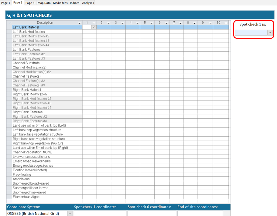
Page 2
Page 2 contains spot-check data. Each line corresponds to an attribute on the second page of the RHS form. Some of the lines are repeated and numbered using the hash sign (i.e #2, #3, #4). These lines correspond to attributes where surveyors can record more than one answer such as bank modification.
You need to input data in all lines except optional lines finishing in '#2', '#3' fields, e.g. 'Left Bank Modifications #2'). This is to ensure that you have not missed any data.
At the top of the page (see red square on the figure below), you can enter information on the location of the first spot-checks and the presence of up to three additional channel substrate types not recorded in the spot-checks and covering more than 1% of the channel bed.
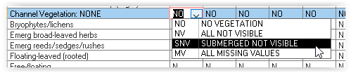
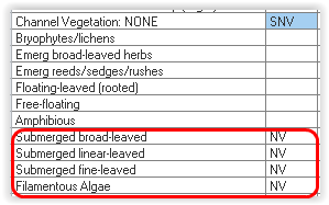
The 'Channel Vegetation: NONE' box will automatically fill spot-check information based on your choice. If you choose 'All Not Visible', it will put 'NV' in all lines for that spot-check. If only submerged vegetation was not visible, you can choose the 'Submerged not visible' option (see below).
Coordinate system
You can choose one of three coordinate systems to reference your site location (see below):
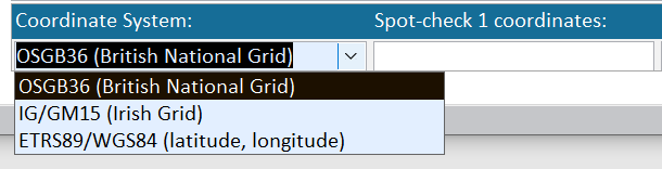
For UK and Irish grid reference systems, you need to provide a 10 figure grid reference e.g. SD8012611641 or O1469834233. Once you have entered the grid reference, it will be automatically converted into latitude and longitude under the WGS84 system (decimal degrees) and in eastings and northings for the mid site grid reference. The conversions will be displayed on the Map Data tab (see below).
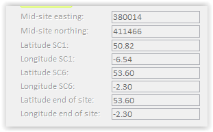
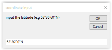
If you choose to enter your data using the WGS84, you need to input the data in decimal degrees (e.g. latitude 50.81 and Longitude -6.54). You can also input the data in degrees/minutes/seconds by double clicking the relevant field (e.g. Latitude 1) and clicking OK. The software will automatically convert the data to decimal degrees.
You can also use the 'Coordinate System' dropdown box to convert WGS84 data to Irish or UK grid reference systems: see link
Data Input Tips